- Mobile Phone Chargers[10]
- Other Electronic Measuring Instruments[10]
- Other Measuring & Analysing Instruments[10]
- Navigation & GPS[10]
- Satellite TV Receiver[1]
- Other Electrical Instruments[2]
- Other Hand Tools[1]
- Measuring Tools[3]
- Level Measuring Instruments[4]
- Theodolites[8]
- Other Measuring & Gauging Tools[10]
- Other Analysis Instruments[3]
- Forestry Machinery[1]
- Gauges[2]
- Hand Tool Sets[1]
- Laser Rangefinders[2]
- Multi-Functional Beauty Equipment[1]
- MIG Welders[4]
- Arc Welders[3]
- Other Welding Equipment[4]
- Integrated Circuits[10]
- Other Electronic Components[1]
- Testing Equipment[10]
- Switching Power Supply[8]
- Other Police & Military Supplies[5]
- Compasses[1]
- Compasses[3]
- Heat Pump Water Heater Parts[1]
- Electric Water Heaters[10]
- Data Processing[1]
- Contact Person : Ms. Woo Lisa
- Company Name : Shenzhen Pengjin Technology Co., Ltd.
- Tel : 86-755-83322229
- Fax : 86-755-25121578
- Address : Guangdong,SHENZHEN,ROOM B3, FLOOR 4TH, JIALE BUILDING, YANNAN ROAD, FUTIAN, SHENZHEN
- Country/Region : China
- Zip : 518018
High-accuracy Survey V8 CORS RTK System
High-accuracy Survey V8 CORS RTK System
Channels Number | 72 | |||
Signal | GPS | L1 Carrier Phase | √ | |
L2 Carrier Phase | √ | |||
L5 Carrier Phase | √ | |||
CA Code | √ | |||
L Code | √ | |||
L1P Code | √ | |||
L2P Code | √ | |||
Glonass | L1 Carrier Phase | Optional | ||
L2 Carrier Phase | Optional | |||
SBAS | √ | |||
DGPS(Real time, Post Process) | √ | |||
Position Accuracy | Static | Horizontal | ±(+1×10⁻⁶D) | |
Vertical | ±(+1×10⁻⁶D) | |||
Fast Static | Horizontal | ±(+1×10⁻⁶D) | ||
Vertical | ±(+1×10⁻⁶D) | |||
RTK | Horizontal | ±(+1×10⁻⁶D) | ||
Vertical | ±(+1×10⁻⁶D) | |||
memory | ||||
Data Communication | Communication Mode | 4 Modes | ||
Internal UHF radio | 16 Channels transmission | |||
Internal network transmission | GPRS/CDMA | |||
External URS Radio Station | √ | |||
External UHF Radio | - | |||
Port | SIM card slot | One embedded | ||
USB port | One embedded | |||
groove | Two embedded | |||
Bluetooth | One embedded | |||
RS-232 Port | Two embedded | |||
Direct | Two embedded | |||
One embedded | ||||
Mainframe Weight (Including ) | ||||
Dust proof, Water proof, Shock resistant | IP67, natural drop | |||
Temperature | Work Circumstance | |||
Storage Circumstance | ||||
Internal Barrery | Two 2800mAh Lithium battery,continuously power supply | |||
Continuous Work Time | One | 6h~8h | ||
Two Batteries | 12h~16h | |||
Mainframe Power Consumption | 2W | |||
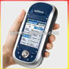
GIS+ Controller Technical Parameter
System | Operation System: Windows CE 5.0 |
Processor: 530MHz high speed ARM920T | |
memory: 128MB SDRAM | |
Display: 3.5inch expert field color touch screen | |
GPS | 12 channels L/A code |
Support WAAS/EGNOS/MSAS | |
Internal high sensitive anti-interfere GPS antenna | |
ApplicationFunction | Internal pixel camera, able to add mark on taken picture |
Inter microphone, able to add voice attribute on point | |
Position Accuracy | Single Positioning: |
SBAS: 1~ | |
Data Storage | Internal ; Flash Memory |
Data Communication | Internal SD card slot, no expand limitation |
Bluetooth, USB, RS232 Port | |
Power Capability | Internal 7.6V Lithium battery, 2000mAh |
Support continuously 12 hours work, available to online charge | |
Physic Capability | Size: 22×9× |
Weight: | |
Work temperature: -~+ | |
Storage temperature: -~+ | |
Water proof: Ip67 | |
Shock Resistant: natural drop |
ApplicationConstruction Lay OutAbundant point and line lay outfunction, assistant by graph operation instruction, save your expenditure in practical construction.Electricity and TransportationFriendly function on power line route direction survey, distance survey and angle calculation; comprehensive survey functionality on road survey, center line, offset survey, profile and cross-section survey.CORS ApplicationSeamlessly compatible wit CORS system, only one RTK rover can receive CORS difference signal and carry out data collection, construction lay out work.CORS Station EstablishmentHD-CORS apply Hi-Target profound experience and mutual technology, stable on operation, long distance on data transmission, is your first choice for City continuous reference stations system..
Control SurveyOnly one investment you can get list of function, V8 Star dual frequency static survey accuracy can satisfy any requirements, config with mutual professional data solution software, you can easily accomplish various high precision control survey work.Data CollectionController operation software designed for GIS application, convenient coding function, meets all your requirements in field data collection work.
Marine SurveyConfig with Hi-Target reputable marine survey software, marine graphical software, and echosounder, can easily apply geodetic survey underwater. Thoroughly change traditional marine survey work mode.
High-accuracy Survey V8 CORS RTK System


