- Mobile Phone Chargers[10]
- Other Electronic Measuring Instruments[10]
- Other Measuring & Analysing Instruments[10]
- Navigation & GPS[10]
- Satellite TV Receiver[1]
- Other Electrical Instruments[2]
- Other Hand Tools[1]
- Measuring Tools[3]
- Level Measuring Instruments[4]
- Theodolites[8]
- Other Measuring & Gauging Tools[10]
- Other Analysis Instruments[3]
- Forestry Machinery[1]
- Gauges[2]
- Hand Tool Sets[1]
- Laser Rangefinders[2]
- Multi-Functional Beauty Equipment[1]
- MIG Welders[4]
- Arc Welders[3]
- Other Welding Equipment[4]
- Integrated Circuits[10]
- Other Electronic Components[1]
- Testing Equipment[10]
- Switching Power Supply[8]
- Other Police & Military Supplies[5]
- Compasses[1]
- Compasses[3]
- Heat Pump Water Heater Parts[1]
- Electric Water Heaters[10]
- Data Processing[1]
- Contact Person : Ms. Woo Lisa
- Company Name : Shenzhen Pengjin Technology Co., Ltd.
- Tel : 86-755-83322229
- Fax : 86-755-25121578
- Address : Guangdong,SHENZHEN,ROOM B3, FLOOR 4TH, JIALE BUILDING, YANNAN ROAD, FUTIAN, SHENZHEN
- Country/Region : China
- Zip : 518018
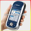
ashtech MobileMapper 100 handheld GPS, Express shipping service/ low price & high quality
ashtech MobileMapper 100 handheld GPS
MobileMapper 100
MobileMapper 100 is the newest generation of GNSS handheld mapping devices introduced by Ashtech. Designed for GIS data collection and mapping, the MobileMapper 100 integrates an open operating system, built-in communications and the Ashtech’s powerful BLADE technology. BLADE allows the MobileMapper100 to operate in extreme GNSS environments while maintaining the high accuracies desired by GIS professionals. Ashtech MobileMapper 100 delivers state-of-the art features in a smart, compact, and lightweight handheld concept that gives users the ultimate field experience. Combined with MobileMapper Field proprietary software or Ashtech Business partners’ offerings, MobileMapper 100 brings the openness, flexibility and scalability needed to answer any mobile GIS requirements.
High-Accuracy HandheldTrue handheld operationsPowerful BLADE processing technologySub-meter, decimeter or centimeter real-time accuracy modesExtended position availability in urban canyons and under canopyDesigned For The FieldCompact & lightweight design for optimal mobility, use and comfort Integrated communications for easy data transfer and GNSS differentialPowerful electronics for fast data collection and seamless processingRuggedized for outdoor use in extreme conditionsFlexibleExtended Connectivity and multimedia featuresWindows Mobile standards for full 3rd party software compatibilityAncillary sensors interfacingGNSS scalability: GPS or GPS/Glonass configurationsCompatible with 3rd party networks (VRS, FKP, MAC)MobileMapper Field and Office SoftwareComplete solution:The Ashtech MobileMapper software suite includes all GIS features that professionals really need without the burden of complicated and rarely used functions. It also provides a direct interface to external sensors such as range laser finders.
Versatile application:MobileMapper Field is the perfect solution for GIS data collection, asset management, area measurements, maps creation and update.
Easy to learn, Easy to use:Ashtech software is very intuitive, requiring a minimum of user training. It enables rapid deployment across the workforce for large scale GIS data collection or maintenance.
Tune MobileMapper 100 to your ApplicationsWindows Mobile Openness:With Windows Mobile 6.5 you may upload any necessary utility or software on your MobileMapper 100, whatever suits your next job. You can collect GIS/GPS points and maps via the GIS application of your choice, either a third party software such as ESRI® ArcPad® or the proprietary Ashtech application.
Software Choice:Take advantage of the solutions that Ashtech Business Partners are offering. Either in Forestry, Agriculture, Utility asset management, Underground cable location, etc… the application choice is large. Specific GIS software or hardware solution combined with your MobileMapper 100 form an accurate all-in-one mobile GIS solution, 100% matching your professional needs
Product specificationsConstellation : GPS, GLONASS, SBASChannels : 45Frequency : L1,L2Update Rate : 0.05 secData format : RTCM 3.1, ATOM, CMR(+), NMEARaw data output : YesReal-time Accuracy - RTK mode (HRMS) : 1 cmReal-time Accuracy - DGPS mode (HRMS) : < 30 cmReal-time Accuracy - SBAS mode (HRMS) : < 50 cmPost-Processed Accuracy (HRMS) : < 30 cm down to 1 cmTime to first fix : 15 secInitialization range : Below 10 kms in L1Processor : 806 MHzOperating system : Windows Mobile 6.5Communications : GSM/GPRS, BT, WLANUnit size (mm / inches) : 190x90x43mm / 7.5x3.5x1.7inWeight : 0.62 kg / 1.43 lbDisplay : 3.5Memory : 256 MB SDRAM / 2 GB NAND / SDHCTemp Min (°C) : -20°C / -4°FTemp Max (°C) : 60°C / 140°FWaterproof : IP 65Shock & vibration : ETS300 019 & MIL-STD-810Power (type - lifetime) : 6600 mAh Li-Ion / > 8 hrsAntenna Type : Internal / ExternalFirmware options : YesSoftware options : Yesashtech MobileMapper 100 handheld GPS, Express shipping service/ low price & high quality


